
Begin a Barbour County Property Search
A Barbour County property search works best as a path from location to parcel. Start there. With a street address, the match is usually quick. Rural land may be easier to find by road name or a nearby landmark. An owner name can narrow the field. A mailing label proves neither the legal boundary nor who holds title. Compare map results and tax records against the deed description. Do that before treating two similar names as one parcel.
Keep physical and mailing addresses in separate notes. The statewide viewer lists the physical address first. Its detail view may show a different mailing address for the owner of record. Treat a result as a lead only. Clear title is a separate question. Confirming it means reading the newest deed, plus any releases or claims, at the custodian. The same path serves a purchase review, a tax question, or a house-history project.
- Search the address or nearby road in the WV Property Viewer. Try a community name or intersection if the street label does not match.
- Open parcel detail and copy the district, map, parcel, suffix, physical address, and legal description.
- Use the key in the Barbour Assessor map-card viewer and the tax inquiry. Note each system’s year and any different mailing or billing address.
- Carry the parcel and owner name to the Barbour County Clerk. Search the newest deed, then check the grantor, grantee, and legal description.
- Save the result link or a KMZ/CSV export for map work. Ask the custodian for an image or paper copy when the screen omits it.
Read a Barbour County Parcel Result
The WV Property Viewer detail panel lists the fields that tie a parcel to tax and map work. Headings and field names are consistent across counties. Values vary by parcel. One caution applies. A parcel can have multiple owners even when the first screen shows only one, so open the full detail before treating a name or mailing address as complete.
| Property owner | Name displayed in parcel detail; co-owners may not all appear in the first view. |
|---|---|
| Physical address | Situs location used to orient the map result. |
| Mailing address | May differ from the situs address and may appear only after opening detail. |
| Parcel key | District, map, parcel, and suffix join the tax, map, and deed trail. |
| Description | Text that may point to a tract or recorded lot and block. |
| Building and values | Building information, cost values, and appraised values are listed as headings. |
| Other context | Flood zone, E911 address, community, delinquent status, and external map links. |
The selected parcel detail screen shows the layout and the report link. It is a viewer example. The displayed parcel is not a Barbour title result.
The image marks the owner and assessment headings. Record the actual result for your parcel and verify it with the Assessor.
Choose a Barbour County Search Key
Address, owner, and parcel keys solve different problems. An address is easy to know. Yet it may carry an alias, a rural route, or a postal city label that differs from official records. An owner name can surface more than one parcel. The online map-card form does not verify owner-name searches, so a parcel number remains the strongest cross-reference once you hold it.
| Search key | Best use | Barbour entry point | Limit |
|---|---|---|---|
| Address | Find a known place | WV Property Viewer or county map | Rural and old street names may differ. |
| Owner name | Follow an individual or entity | Clerk index, if searchable; ask Assessor | No owner-name control was verified on the map-card screen. |
| Parcel/APN | Join tax, GIS, and deed records | Map card, GIS, Tax Inquiry | Keep leading zeroes and suffix digits. |
- Parcel or APN
- A tax and map identifier for a land unit.
- Situs address
- The physical place, separate from the mailing address.
- Owner of record
- The name shown in a public roll or deed, not a title opinion.
Search is a starting point. A Barbour County property search does not guarantee that title is clear or that a map line is surveyed. Compare the recorded instrument and seek a title professional or licensed surveyor for a binding answer.
Barbour County Assessor Search Fields
The local map-card viewer exposes District and Map/Parcel controls. District is a select menu. The Map/Parcel area mixes selectors with a text input, and the screen does not state exact formatting or required fields. Search and submit buttons render without labels.
| Field label | Control | Required | Format note |
|---|---|---|---|
| District | Dropdown | Not stated | List loads dynamically. |
| Map/Parcel | Two selectors and text input | Not stated | Screen does not print a syntax guide. |
| Search or submit | Button/input | Not stated | Control labels were not accessible. |
The screen notes that map-card copies require a visit to the Assessor. That is a real access limit. Use the online display to identify the parcel, then request the card at 26 N. Main in Philippi. The Assessor's phone is (304) 457-2336. The search path stays useful even when the final copy is offline.
Do not treat this interface as an owner-name tool. If a name search is needed, ask the Assessor what current method exists, or start from a parcel identified by address. A blank online field does not mean an owner holds no property. Names may simply search better in person.
The Barbour Assessor map-card viewer shows the District and Map/Parcel controls and notes that card copies require an office visit.
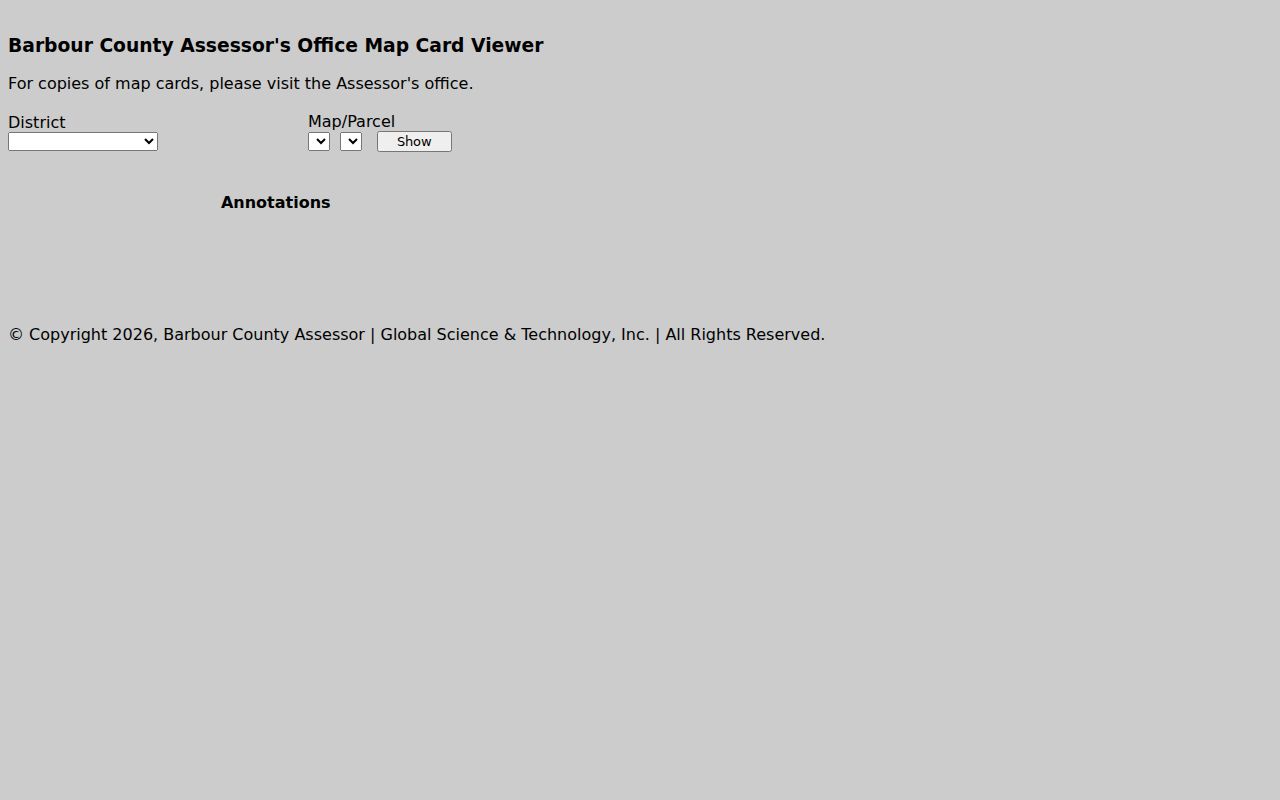
This is the parcel key used across local records. Ask the Assessor for a card copy when the online view does not provide one.
Barbour County Parcel Number Format
The statewide format uses a two-digit district, a four-digit map, a four-digit parcel, and a four-digit suffix, with leading zeroes filling short parts. The help example is 01 2345-6789-0123. Barbour's Assessor screen is district and map-parcel based. It does not print a local syntax. Treat the statewide example as a guide to the shape only.
A suffix matters. Two records can share a broad map area yet refer to distinct assessed units. Copy every digit from the tax ticket or map card. The Sheriff Tax Inquiry also displays Map-Parcel. The Clerk's deed uses a legal description that may not repeat the modern key. Keep all three together rather than rewriting an older description into a guessed address.
For an uncertain key, ask the Assessor. A tiny transcription error can point to the wrong tract or return nothing at all.
Barbour County Address Variants
The E911 form in Barbour County asks for a road name, nearest intersection, driveway distance, tax parcel, subdivision and lot, flood permit, and a map. A rural property rarely fits one street line. The land may hold a newer assigned address while an older deed describes it by a stream, community, district, tract, or adjoining owner. A failed search does not mean the parcel is missing.
The completed form goes to Mapping and Addressing at 111 Overlook Drive in Philippi. Instructions call for a marked driveway before a residential application is returned, and they set a minimum processing time of one week. New addresses also depend on the county floodplain permit. Keep the approved E911 address beside the deed description. That pairing pays off when a road name changes or the tax roll still carries an older label.
Postal cities are clues. They are not boundary tests. Philippi 26416, Belington 26250, and Junior 26275 can all reach rural county land outside the incorporated place. Use GIS or E911 to test the actual location.
Barbour County Tax Search Cross-Check
The tax inquiry accepts a year, type, ticket or name, and a map-parcel path. Its grid returns the totals, both halves, balance due, account number, description, billing address, and map-parcel. A bill is a fiscal record. It is not the deed that transferred title. If the billing name differs, check the latest Clerk instrument instead of assuming either record is wrong.
Use the same key everywhere and note the year. A tax account can carry a mailing address far from the property, so the billing address alone proves little. The tax page lists the payment and delinquency calendar and adds a 2.3 percent surcharge for online payments. A posted payment changes the balance, so verify with the Sheriff Tax Office before trusting a saved result.
The property search gains strength. The map, tax ticket, and deed should agree. When they do not, pause. Ask the custodian to reconcile the parcel rather than choosing one screen as the answer.
Where Barbour County Online Search Stops
The Clerk Document Inquiry link does not load. The exact deed fields, oldest year, document choices, and image access stay unpublished. The statewide Cott system advertises account access and image pricing. Barbour-specific coverage is not listed. Do not assume every old transfer is searchable online.
When the web route stalls, call Pamela Spencer's office at (304) 457-2232 or visit the County Clerk at 26 N. Main. Have a parcel key ready. A book/page citation or date range works too. Ask staff to search both grantor and grantee names. Staff can also locate the original book, image, or microfilm. For a specific non-exempt record, a written request under West Virginia FOIA can state the parcel, instrument, or date range and ask for a reproduction estimate.
The historical cutoff is unclear. Barbour's deed books reach into the nineteenth century, but exact indexes and image years must be confirmed with the Clerk or archives.
Use a Barbour County Search Result
Keep each search record brief and repeatable. Note the address as displayed, the parcel number with its zeroes, owner spelling, legal description, system, assessment or tax year, and the date you checked. Save a result link when the system offers one. A KMZ or CSV export can help with map work, but verify its data date. An export is never a survey.
For a transaction, request the latest deed and check releases, liens, plats, or court filings that may affect the parcel. The County Clerk's index is the official path for recorded instruments, while the Assessor and Tax Office answer tax questions. The online result cannot certify anything. It only points to those records. The Barbour County property search works best when each result ends with a clear custodian and a parcel identifier.